
According to satellite imagery, Japan’s Noto Peninsula was rattled and slightly enlarged when a 7.6-magnitude earthquake struck on January 1.

Preliminary satellite analysis and on-the-ground surveys have found that the earthquake raised land along the coast — a process called uplift — by as much as 4 meters, roughly 13 feet.
That means the sea floor along the coast has now risen above the water in many places on the Noto Peninsula, creating newly exposed beaches.
In some places, the earthquake extended the coastline by as much as 250 meters, or about 820 feet, according to a statement from the University of Tokyo. That’s about the length of 2.2 American football fields.
Locals fishing in a bay on the peninsula reported that “the entire coastline was uplifted at the time of the earthquake, that the uplift in the bay occurred at the same time as the earthquake, and that the tsunami in the bay did not run up to the raised port,” the university’s statement said, according to a Google translation from Japanese to English.
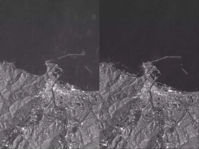
The Geospatial Information Authority of Japan published a preliminary satellite analysis of the Noto Peninsula. Comparing satellite images from June 2023 with images from the days after the earthquake, the agency identified multiple regions where new coastline has emerged.
The university said its investigation along the coast was ongoing.